
Digital twins & LiDAR
Asset resilience
On-site LiDAR scanning, 3D photogrammetry, and facility modelling create an accurate operating picture so teams can plan maintenance faster and answer inspection questions with evidence.
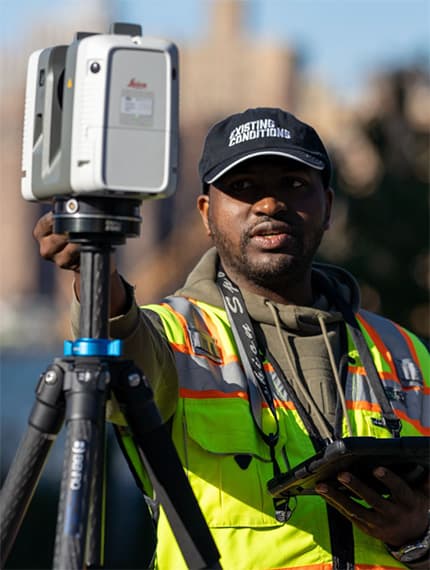
Our field teams deploy survey-grade LiDAR and drone-based photogrammetry to capture the facility as it actually exists.
The result is a living digital twin that gives engineering, operations, and contractors one trusted view for planning, shutdown preparation, modification work, and inspection support.
Capabilities
What we help you improve
Turn measured site conditions into information your teams can use for maintenance, engineering, and inspection.
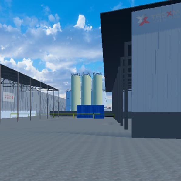
One reference for the facility as it exists
- 01
Survey-grade point-cloud capture
On-site LiDAR scanning and photogrammetry establish the measured baseline for your facility. Engineering and maintenance teams can verify dimensions, access, and spatial relationships against current site data.
OutputMeasured point clouds - 02
Current as-built 3D models
Point-cloud processing, facility modelling, and BIM integration turn captured data into usable digital assets. Teams can review equipment layouts and prepare modification work before returning to the field.
OutputUsable as-built models - 03
Inspection and compliance zone mapping
Connect inspection areas and supporting site records to a clear spatial reference. Operations, HSE, and contractor teams can locate the information needed for work preparation, inspections, and internal reviews.
OutputSpatial inspection references - 04
BIM / CAD integration and change tracking
Integrate the captured baseline into engineering workflows and keep a record of facility changes. Scheduled updates help prevent drawings, models, and supporting documentation from drifting away from site conditions.
OutputConnected engineering records
Delivery and continuity
How an engagement works
Agree how the assets will be used, capture the site, and verify the outputs before keeping them aligned with future changes.
- 01Project delivery
Define the scope
Review the facility, documentation gaps, access constraints, and intended uses with engineering and operations teams.
What you receiveAgreed capture scope and deliverables
- 02Project delivery
Capture the facility
Use on-site LiDAR and photogrammetry to record equipment, structures, and spatial relationships against the agreed scope.
What you receiveA measured site baseline
- 03Project delivery
Process and verify
Turn captured data into usable models and records, then check the outputs against project requirements before handover.
What you receiveVerified models and supporting records
- 04Continuing support
Maintain the baseline
Plan re-scans and documentation updates around facility modifications so the digital reference continues to support decisions.
OngoingCurrent assets and change records
Operational efficiency and compliance support
Explore what operational support looks like for your facility
Every operation is different. Tell us where delays, training gaps, or compliance pressure are building, and we'll outline a tailored approach.